
Arctic Chill Grips the UK: Snow and Ice Warnings Issued
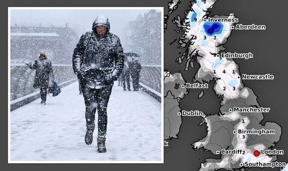
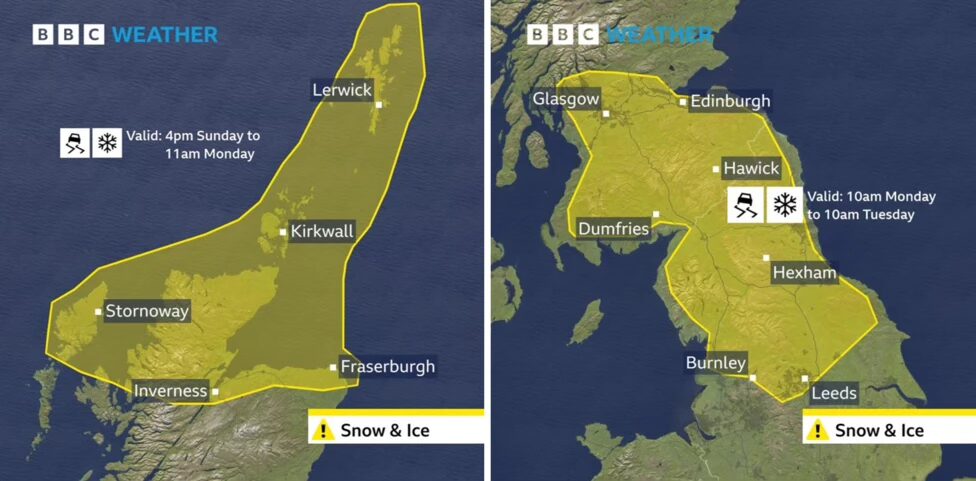
The United Kingdom is bracing for its first significant taste of winter as Arctic air surges southward, bringing snow, ice, and below-average temperatures. The Met Office has issued yellow weather warnings for snow and ice, covering parts of northern Scotland from Sunday evening and extending into northern England and southern Scotland on Monday and Tuesday.
Snow and Ice Expected in Northern Regions
The wintry weather is set to begin in northern Scotland on Sunday afternoon, where snow showers are expected to develop. Higher ground could see 5-10cm of snow accumulation, while lower levels might experience 1-3cm. With overnight temperatures dropping significantly, ice is likely to become a concern, especially on untreated roads and pavements.
By Monday, a weather system moving in from the Atlantic is expected to interact with the Arctic air. This could lead to snowfall along its northern boundary, particularly over higher ground in Northern Ireland, northern England, and southern Scotland. The Pennines may receive up to 15-20cm of snow, which could result in travel disruptions. Lower-elevation areas are also at risk of snow, with potential accumulations of 2-10cm depending on the intensity of the precipitation and ground temperatures.
Frosts and Meteor Showers
While the wintry conditions may cause some inconvenience, the cleaner Arctic air brings a silver lining: clear skies. On Sunday night, stargazers may catch a glimpse of the Leonid meteor shower, a celestial event not to be missed.
Frosty mornings will become a regular feature in the coming week, with temperatures falling below the seasonal average.
Will the Cold Spell Persist?
This chilly spell is expected to last for about a week, bringing a mix of sunny skies, frosty mornings, and wintry showers. Northern areas and higher elevations are most likely to experience snow showers, with accumulations particularly on higher ground.
Despite the wintry outlook, the ground remains relatively warm in mid-November, which could limit the snow’s ability to settle in lower areas. However, towns and cities at lower elevations should still prepare for potential disruptions.
Staying Safe in Wintry Weather
With snow and ice on the horizon, here are a few tips to stay safe:
- Plan Ahead: Check local forecasts and plan your journeys accordingly.
- Stay Prepared: Ensure your vehicle is winter-ready with appropriate tires and emergency supplies.
- Dress Warmly: Layer up to protect yourself from the biting cold.
The transition to winter weather can be sudden, but with a bit of preparation, we can all stay safe and make the most of the season. For a detailed look at what’s to come for the rest of November, stay tuned for our latest monthly outlook.